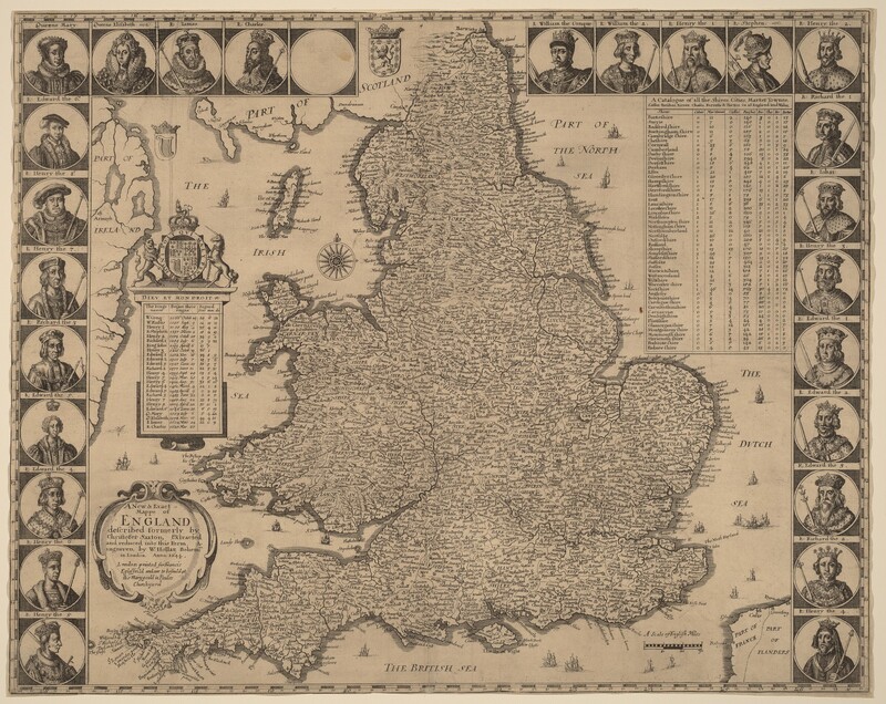
A New and Exact Mappe of England
Wenceslaus HollarWW-1644-275742
1644·etching and engraving on laid paper·sheet (trimmed to plate): 37.9 × 47.8 cm (14 15/16 × 18 13/16 in.)
Catalogue
- Year
- 1644
- Dimensions
- sheet (trimmed to plate): 37.9 × 47.8 cm (14 15/16 × 18 13/16 in.)
- Collection
- National Gallery of Art
- Artist
- Wenceslaus Hollar
Artist

More
More by Wenceslaus Hollar

English Noblewoman
1673 · Etching on ivory laid paper
WW-1673-071395
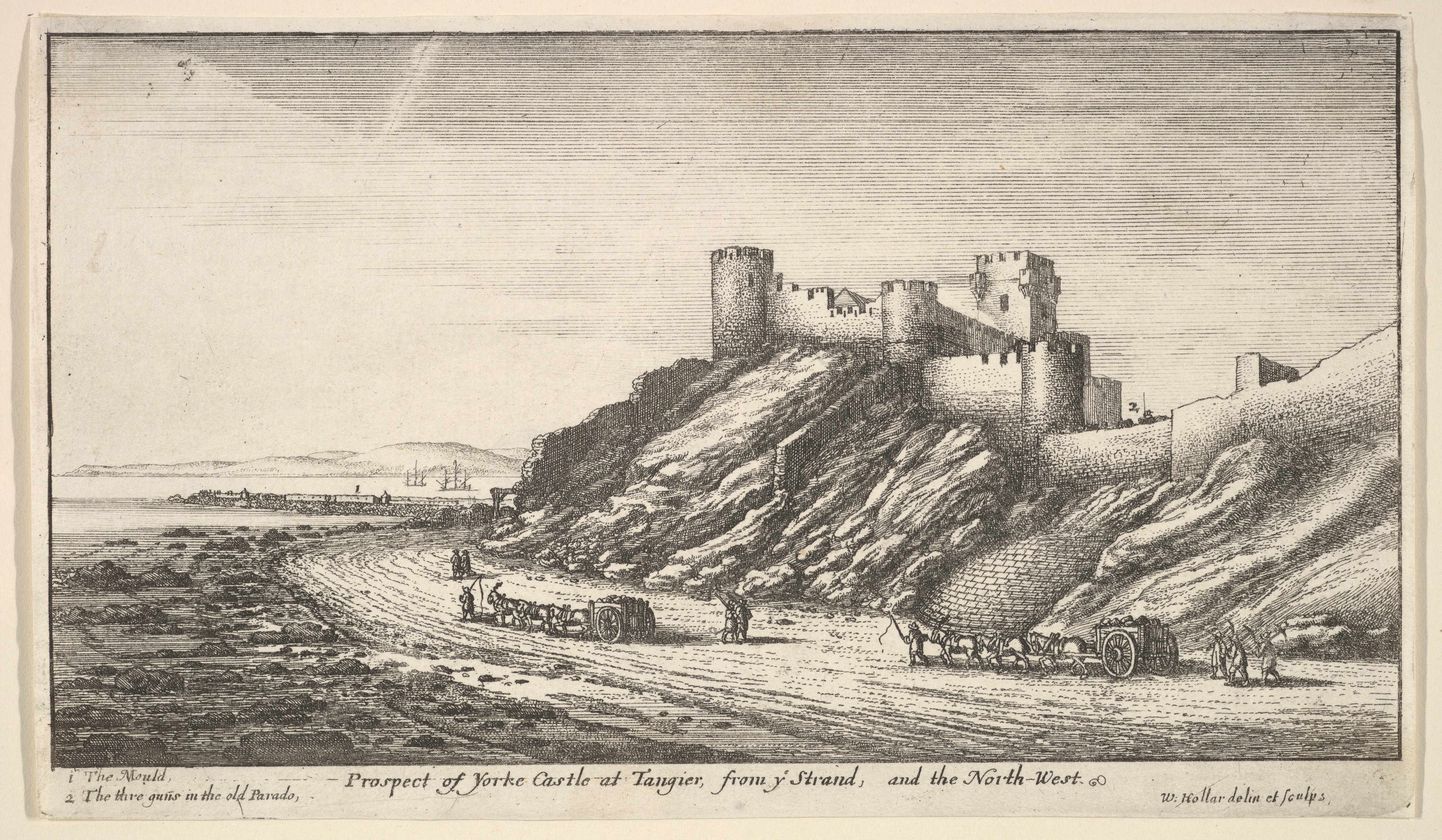
Prospect of Yorke Castle at Tangier, from ye Strand, and the North-West, from "Views of Tangier"
1669 · Etching; first state of two
WW-1669-055670
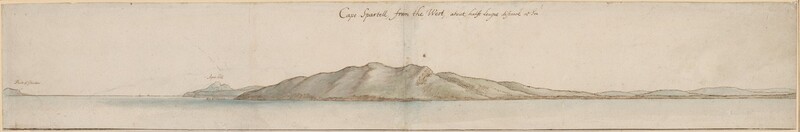
Cape Spartell from the West
1669 · pen and brown ink with watercolor over black chalk on two joined sheets of laid paper
WW-1669-276451

Warships and a Spouting Whale
1665 · Etching on ivory laid paper
WW-1665-073140

Warship in the Trough of a Wave
1665 · Etching on ivory laid paper
WW-1665-073142

Galley
1665 · Etching on ivory laid paper
WW-1665-073144
Record
Verified by WattsOS- Artist
- Wenceslaus Hollar
- Year
- 1644
- Dimensions
- sheet (trimmed to plate): 37.9 × 47.8 cm (14 15/16 × 18 13/16 in.)
- Watts ID
- WW-1644-275742
Source
- Collection
- National Gallery of Art
- Source
- nga
- Reference
- View at source
- Status
- verified